Custom Map Markers
Feature Overview
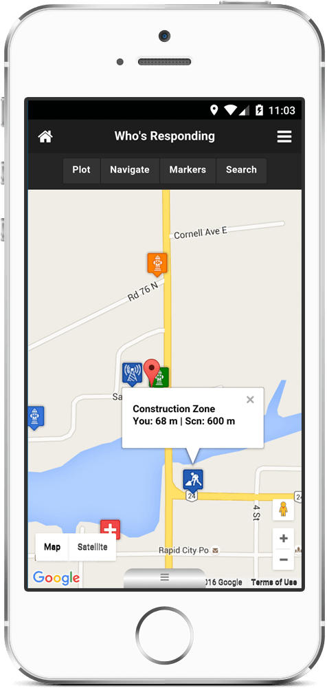
Who's Responding provides the ability to place markers on a map, for example to mark the locations of water sources, AEDs, road works, etc. Each marker can have a selectable icon and caption. During a response you can easily click on any water source and get the "as the crow flies" distance from scene to water source.
Tapping on a map marker will display the distances between the marker and the user, and between the marker and the scene. This can be used, for example, to determine the nearest hydrant to a burning building.
45-day Free Trial-
Supported Platforms